This page preserves prior project descriptions, reference maps, and past updates for historical context. For the most current construction update summary, visit the main project page: McCoys Creek Restoration Project (Current Updates) .
Road Closures, Detours & Reference Maps
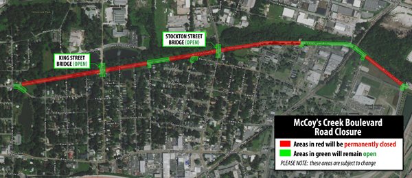
The map and PDF below are retained here for reference and historical context.
.png.aspx?width=800&height=535)
Download the Stockton Street Bridge Closures Map (PDF)
Past Project Status Updates
The sections below reflect previously published status language and images. Dates and “scheduled completion” references are maintained for historical context.
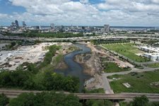
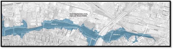
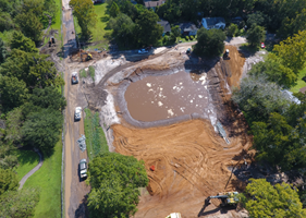
McCoys Creek Outfall: May Street to St. Johns River
Scheduled Completion: Fall 2025
Construction at the McCoys Creek Outfall is in progress. Stream restoration continues to widen and deepen the creek, which will increase capacity. Additional work will remove concrete culverts, “daylight” the creek and widen the outfall.
 |
| McCoys Creek Outfall – May 2024 |
In July 2024, the Northbank Riverwalk in the McCoys Creek Work Zone will be closed to all pedestrians and bicyclists. The existing structure will be removed, replaced, and is scheduled to reopen in the Fall of 2025.
For more information on the City of Jacksonville’s projects, visit Mayor's Transparency Dashboard.
Future construction on McCoys Creek Outfall includes floating wetlands, recreational features and park space with native plantings and trees.
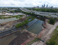
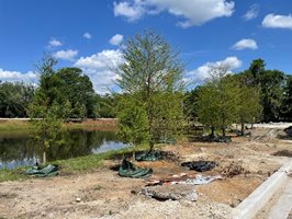
McCoys Creek Stream Restoration
Phase I: Leland Street to I-95
Scheduled Completion: Fall 2024
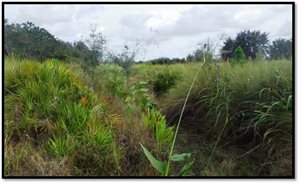
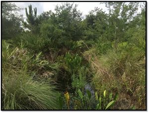
Stream Restoration: Construction on McCoys Creek stream continues and the stream is both wider and deeper and with a vastly increased floodplain. Newly-built banks restore the natural meander of the creek and are stabilized with native plantings.
 |
 |
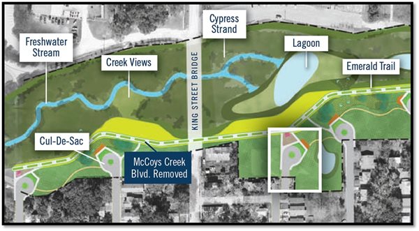
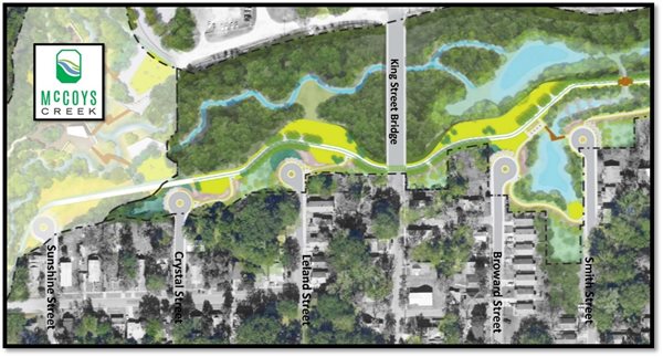
McCoys Creek Boulevard
Removed in August 2021 |
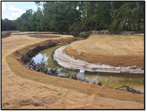
Natural Channel Design - July 2023
Leland Street to King Street Bridge |
 |
 |
 |
Native plantings help stabilize
the heightened banks of the creek.
September 2023 |
Natural Channel Design – May 2024
Copeland Street to Myrtle Street/I-95
|
Trail & Recreation Plan: Design is complete on the Phase I Trail & Recreation Plan. The project is expected to begin construction in 2025.
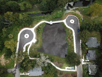
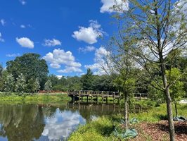
Neighborhood Cul-de-Sacs: All cul-de-sacs in the McCoys Creek neighborhood are complete, with improved drainage. Broward Pond is a park space with a small pavilion, a boardwalk and native landscaping, including new trees. Rock pools provide drainage and integrate the pond with the new stream.
 |
 |
| Cul-de-Sac - August 2021 |
Cul-de-sac -- March 2022 |
Broward Pond: The pond on Broward Street is a new park space, with a small pavilion, native landscaping, and a boardwalk. Rock pools will be constructed and will improve drainage by integrating the pond with the stream.
 |
 |
Broward Pond & Cul-de-Sacs
August 2022 |
Broward Pond
September 2023 |
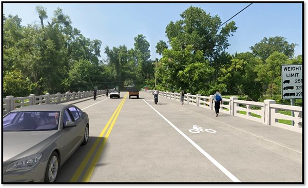
King Street Bridge Replacement
Scheduled Completion: Summer 2025
King Street & Stockton Street Bridges: The Kings Street Bridge is under construction and scheduled to for completion in Summer 2025. Construction on the Stockton Street Bridge will begin when the King Street Bridge reopens and is scheduled for completion in Fall 2026. Both bridges will be elevated and widened, with paths for pedestrians and bicyclists.
 King Street Bridge is under construction.
May 2024
Frequently Asked Questions & Background
What is the McCoys Creek Restoration Project?
The City of Jacksonville has committed $105.4 million over the next three years to restore McCoys Creek to a natural state and in the process, mitigate the ongoing and chronic flooding on McCoys Creek Boulevard and in the nearby neighborhoods.
Groundwork Jacksonville, a local nonprofit, has partnered with the City to engage residents and community stakeholders on a vision plan and design for McCoys Creek that will reduce flooding, improve water quality, restore and add fish and wildlife habitats and create a more resilient ecosystem.
In addition, the project will provide parks, trails, access to creek and recreation opportunities and other amenities. Bridges on Stockton and King streets will be replaced with new bridges at higher elevations. Bike paths and sidewalks will be added to both bridges.
Where is McCoys Creek located?
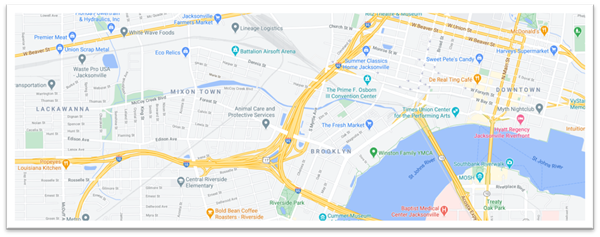
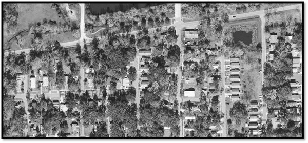
McCoys Creek is located west of downtown Jacksonville. The head of McCoys Creek is just west of Leland Street and then travels southeast through several neighborhoods, including Lackawanna, Mixon Town and Brooklyn as well as the Rail Yard District. The creek outfalls to the St. Johns River near the Acosta Bridge.
What is included in the McCoys Creek Restoration Project?
- Creek restoration (flood mitigation)
- Removal of McCoys Creek Boulevard
- Construction of cul-de-sacs and additional roadwork
- Elevation and replacement of King and Stockton Street bridges
- Trail construction (Emerald Trail)
How will this project benefit the areas adjacent to McCoys Creek?
In addition to flood mitigation, the McCoys Creek Restoration will include:
- Trees and native plants
- Landscaping, lighting and benches
- Picturesque green spaces
- Neighborhood sidewalks and trails
- Connections to the Emerald Trail
- Open views and access to McCoys Creek
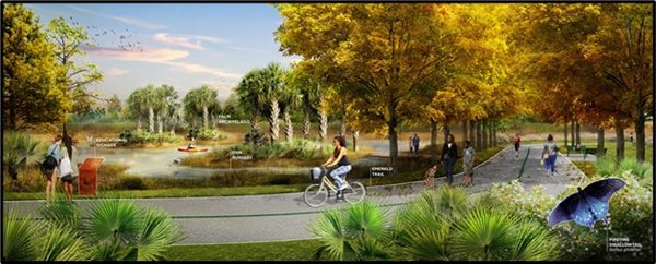
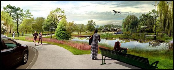
Concept: Emerald Trail in McCoys Creek
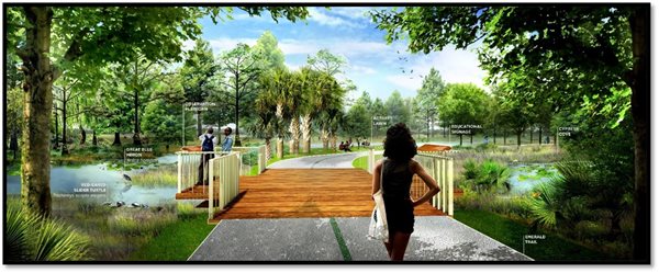 Concept: Park overlook in McCoys Creek
How will this project impact traffic?
When McCoys Creek Boulevard is removed, Edison Avenue, Stockton, King and Forest streets will become the main travel routes to and from the community.
McCoys Creek Boulevard will remain open from Cherokee Street to Fitzgerald Street, providing access to McDuff Avenue, and from Claude to Goodwin streets to provide access under the railroad crossing.
Traffic studies show that the alternate routes will create no more than a 20 percent increase in traffic — below FDOT capacity guidelines — and will have minimal impact on emergency response time. Residents should also see fewer commercial vehicles traveling through the neighborhood.
What is the current status of McCoys Creek Boulevard and the nearby roadways?
McCoys Creek Boulevard from Cherokee Street to Margaret Street has been removed permanently and new cul-de-sacs have been constructed on the following streets: Sunshine, Crystal, Leland, Smith and Broward. Nixon Street has been reconstructed and provides access to nearby properties and roadways. Greenways, landscaping and sidewalks have been added.
Will there be any more construction in the neighborhood on the roadways?
Limited construction will continue and focus on drainage and litter removal devices.
Is McCoys Creek Boulevard going to be removed permanently?
Yes.
Why is McCoys Creek Boulevard being removed?
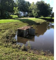
McCoys Creek Boulevard is a low-lying road that is located squarely in the floodplain of McCoys Creek. Minimal rain causes the creek to overflow and routinely floods the road and into nearby neighborhoods.
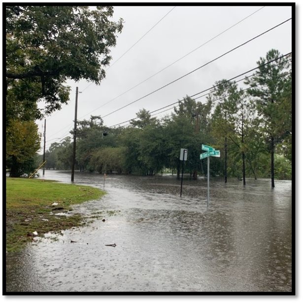
Flooding on McCoys Creek Boulevard
Concept: Natural flood mitigation features in restored McCoys Creek
How will the restoration project fix the flooding?
In the past, McCoys Creek was forced into an artificial straight line – a channel – and critical flood plains were destroyed. The stream restoration project will restore natural channel design – a meander – to McCoys Creek, expand the flood plain and provide more room for water runoff. In addition, the project will deepen the creek and add natural water containment features, such as lagoons and tidal pools.
Current: Artificial straight channel
Future: Natural meandering design with expanded flood plain
What will happen to the King and Stockton Street bridges?
Both bridges will be replaced with new bridges at higher elevations. The new bridges will have sidewalks and bike lanes.
Concept: Stockton Street Bridge
What will happen to the roads that currently connect with McCoys Creek Boulevard?
Six roads will be impacted by the removal of McCoys Creek Boulevard. Of those six, five will become cul-de-sacs with landscaping, lighting and sidewalks that connect to the Emerald Trail. Those new cul-de-sacs will be on Sunshine, Leland, Crystal, Smith and Broward streets. The intersection of Nixon St. and McCoys Creek Boulevard will be reconstructed to maintain access to several properties east of Nixon Street.
McCoys Creek: Current
McCoys Creek: Future
What will the cul-de-sacs look like?
Cul-de-sacs with new trees, landscaping, lighting, connecting trails and sidewalks will be constructed at the end of five roads that currently intersect with McCoys Creek Boulevard. The cul-de-sacs are designed so emergency responders (police and fire), sanitation trucks and maintenance vehicles have convenient access to nearby properties.
Concept cul-de-sac in McCoys Creek
Concept: cul-de-sac(s) at Broward and Smith streets
Will I still have access to my home or business?
The project has been planned to ensure residents and businesses have access to their property both during and after construction. There are a few properties that will be permanently impacted by the closure of McCoys Creek Boulevard. The City is working with each of these property owners to develop practical solutions.
What has been done with the pond on Broward Street?
The pond on Broward Street has been redesigned into a park space, with a seating area, native landscaping and a boardwalk. New drainage, litter traps and a series of rock pools have been constructed in anticipation of restoration work on the creek.
Broward retention pond - 2020 |
Broward pond construction - February 2022 |
Trees and landscaping – April 2022 |
Broward Pond – June 2022 |
Historical Planning & “What to Expect”
The content below was previously used in the page’s sidebar to explain upcoming phases and what residents might see over time. It is retained here for historical context.
What is next for the McCoys Creek Restoration Project?
Next steps include the following:
- Stockton Street Bridge Replacement (Scheduled to begin: Summer 2025)
- Phase I: Trail & Recreation Construction (Expected 2025)
- Brooklyn Design (In-progress)
Additional phases of the project include restoration and design work of the creek from I-95 to the outfall at the St. Johns River. Recreational features, such as parks, active space, seating and creek overlooks are part of the overall project plan.
What will residents see when construction begins on the McCoys Creek channel?
The restoration plans for McCoys Creek will restore the creek to a more natural design while also widening and deepening the waterway. This expanded floodplain will help manage stormwater in the area. Construction on the McCoys Creek channel was expected to begin in Summer/Fall 2022.
The creek and landscape designers have extensive experience in projects of this type and expect that existing wildlife and birds will readily adjust by relocating to new habitats. However, native vegetation will take several years to take root and fully integrate into design of McCoys Creek.
Year 1: Initially, the McCoys Creek restoration project will be a construction site. Birds and other wildlife will temporarily migrate to nearby wooded areas.
Year 3: By year three, newly planted trees, native plants and grasses are rooted, expanding and flourishing.
Year 7: By year seven, the area will be lush with native plants and trees.